
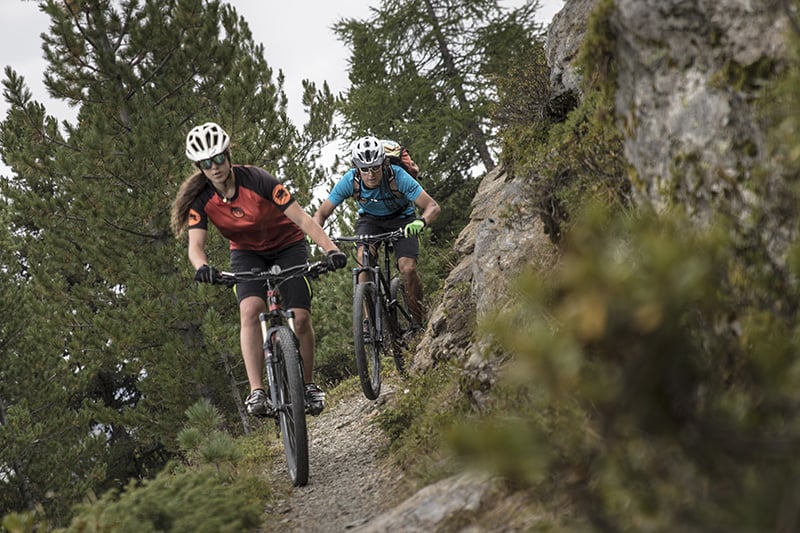
Hundreds of kilometers of cross country mtb trails among mule tracks, dirt roads and single trails. You have the technical path for the expert biker and the easy trail, for a family adventure or for those who like to take it easy.
Cross Country mtb | Advised itineraries
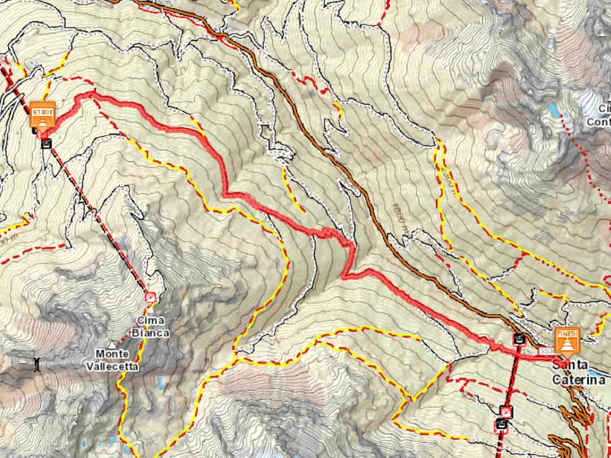
1) Ride into the woods | Bormio 2000 – Santa Caterina Valfurva
In Bormio 2000 there is an enchanting mtb ride that goes into the woods within the Stelvio National Park!
Once you reach Bormio 2000, follow the flat dirt read S543 which taks you through the pine forest towards “Baita Pozzo dell’Acqua”. Continue until you find a juncture and take S543.2 which goes down to “Monti di Sobretta”. Follow then S518 until “Sobretta di Sotto” and turn left on S522 to finally arrive to Santa Caterina Valfurva. The last downhill part is very technical and so is recommended only for expert bikers.
You may wanto return to Bormio by bus or by mtb on paved road (12 km all downhill, from 1,738 m to 1,225 m).
Technical data
- Length 11,662 km
- Height difference uphill 400 m
- Height difference downhill 585 m
- Maximum slope uphill 23 %
- Maximum slope downhill 18 %
- Maximum quota 2,137 m
- Minimum quota 1,740 m
- Accessibility for bikes 100 %
Pavement statistic
- Natural pavement 95%
- Asphalt pavement 5%
 Download the itinerary Ride into the woods in pdf format: Ride into the woods (ITA)
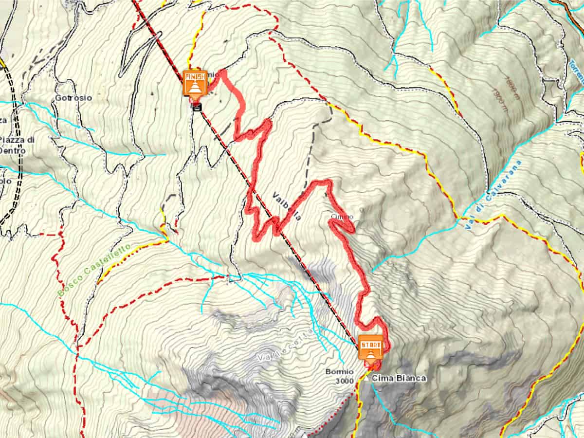
2) All downhill! | Cima Bianca – Bormio 2000
From Cima Bianca to Bormio 2000, more than 1,000 meters of vertical drop on a dirt road. Max fun, breathtaking views and no strain.
Reach the peak of the mountain with the cablecar “Whitelady3000” and from Cima Bianca follow the dirt road (S541 e S542) which, with wide turns, takes you to La Rocca. From here turn left on S543.1 and finally on S543 to Bormio 2000.
Technical data
- Length 7.224 km
- Height difference uphill 0 m
- Height difference downhill 1,080 m
- Maximum slope uphill 0 %
- Maximum slope downhill 17 %
- Maximum quota 3,000 m
- Minimum quota 1,920 m
- Accessibility for bikes 100 %
Pavement statistic
- Natural pavement 100%
 Download the itinerary All Downhill! in pdf format: All downhill ! (ITA)
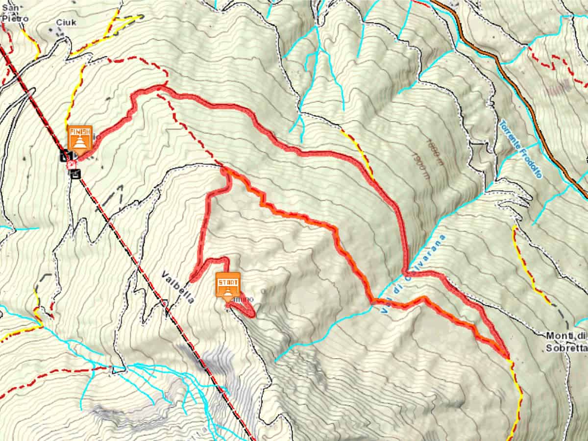
3) What a view! | Cimino – Bormio 2000
Take the chairlift Bormio 2000-Cimino. Once you have reached Cimino, take the dirt road S541, all downhill for about 1 km, until you find the top station of the ski lift Rocca Est. From here turn right on the single trail S542, towards “Baite di Sobrette”. The single trail is within the Stelvio National Park and offers marvellous views of the valley. At the first juncture turn left on S543 and then proceed all the way to Bormio 2000.
Technical data
- Length 11.02 km
- Height difference uphill 122 m
- Height difference downhill 808 m
- Maximum slope uphill 15 %
- Maximum slope downhill 19 %
- Accessibility for bikes 100 %
Pavement statistic
- Natural pavement 100 %
 Download the itinerary What a view! in pdf format: What a view! (ITA)
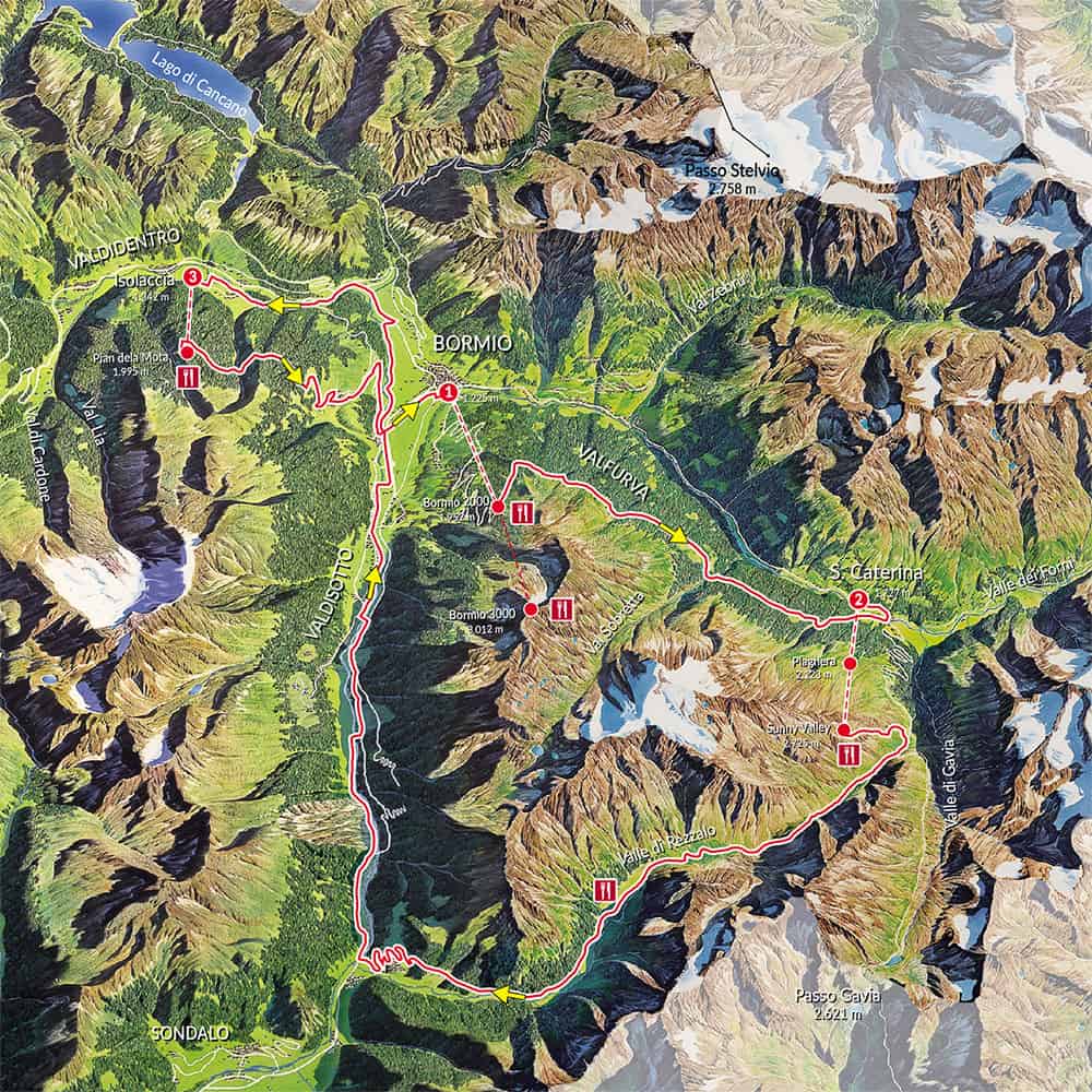
4) Go big or go home! | 3 Gondole Tour
From Bormio take the cable car up to Bormio 2000.
From here you cycle along the “strada dell'acqua" (water road) that leads to Santa Caterina. 11 km on a mostly flat dirt road surrounded by greenery with beautiful views of Valfurva.
Descend to Santa Caterina.
From here you go up again in altitude by cable car to reach the refuge Sunny Valley. You arrive at the Passo dell’Alpe and from here starts the long descent of the Val di Rezzalo. The first stretch is a path, then a road with more flat, until it becomes a driveway.
Once you reach Frontale you continue downhill to Le Prese. From here you start the climb on the provincial road. After the village of Verzedo, leave the paved road and turn left to continue for about 3 km on a dirt road that runs along the river Adda. Passing through Aquilone you reach Tola where you enter the Sentiero Valtellina, a paved cycle path that runs along the river for about 9 km until you return to the provincial road of Premadio. Continue to Seghetto and from here return on the bike path to Isolaccia where take the Isolaccia-Pian de La Mota cable car.
At the top of the Conca Bianca refuge, descend along the paved road that leads to Forte di Oga. Continue towards Oga, a small characteristic village, and descend along the dirt road that leads to Via Osteglio to the village of Santa Lucia. From here take the cycle path that runs along the Frodolfo stream to return to Bormio.
Technical data
- Minimum altitude: 951 meters
- Maximum altitude: 2,700 meters
- Distance with MTB: 66 km
- Total elevation gain: 3,360 meters
- Total elevation gain: 3,361 metres
- Pedaling ability: 100%
Buy the ticket for the 3 Gondole tour on our shop
 Download the itinerary 3 Gondole! in pdf format: 3 GondoleAll the information, texts and data on this page are freely inspired by all the sources from Comunità Montana Alta Valtellina: